

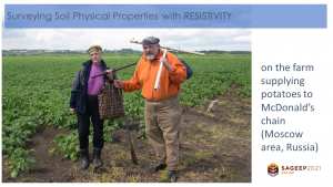
Applications of electrical geophysical methods in agriculture including precision agriculture and horticulture, soil mapping, stone and salt content mapping, detection of groundwater level and peat deposits.
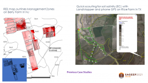
One of the challenges facing the adoption of precision agriculture technology is the identification of productivity-related variability of soil properties accurately and cost-effectively