 We have a few new models of LandMappers in stock in the USA and Europe!
- Please, CONTACT US to discuss the suitability of LandMapper ERM-03 or ERM-04 for your applications.
- Compare new LandMapper ERM-03 vs ERM-04 model capabilities.
- Landmapper_Applications on one page PDF
- Compare LandMapper_ERM03-04_flyer PDF
- LandMapper Benefits 3-fold Flyer PDF
- LandMapper measurements range for Resistivity/Conductivity
MANUALS AND TECHNICAL SPECS
- LandMapper ERM-03/-04 User Manual and Case Studies PDF
- LandMapper ERM-03/-04 Tech Specs PDF
- LandMapper ERM-03/-04 Руководство Пользователя PDF
- LandMapper ERM-03/-04 Технические Характеристики PDF
- Windows OS Software to download measurements from ERM-03/-04 and customize measurements: ZIP (unzip in a folder on the local drive and run EXE file)
The software downloaded from this site is developed by Landviser and checked virus-free, by Windows Defender, Malwarebytes, McAfee Antivirus, and Norton Security. 
 The App has not been signed yet with Microsoft and displays “Unknown Publisher” and warning about potentially harmful applications downloaded from the web. Click”Run Anyway”and the start screen would display. On the subsequent runs on the same PC warning disappears.

You can rest assured that that file is safe, but encouraged to run a virus check on the downloaded file with other antivirus programs and sent us feedback to info@landviser.net.
We offer a full range of geophysical instruments and software:
|
|---|
Want to learn more? We explain complex technologies in simple terms!
Register at our Geo-Tech Support Portal @ https://in.landviser.xyz
You can even install our Support App for iOS or Android from the link above!

Accuracy>99%

Safe & reliable standard:
9 V battery
PC connected for data transfer
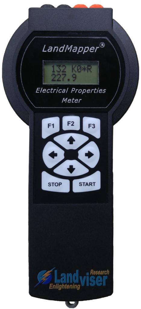
LandMapper ERM-04 is the newest device of Landviser, LLC. It can measure electrical resistivity (ER), conductivity (EC), and potential (EP).
LandMapper ERM-04 measures electrical resistivity or conductivity of soils and related media for express non-destructive mapping and monitoring of agricultural fields.
In a typical setting, a four-electrode probe is placed on the soil surface and an electrical resistivity or conductivity value is read from the digital display. The device measures electrical resistivity or conductivity in a surface soil layer of the depth from 2 cm down to 20 m.
 LandMapper ERM-04 is the most versatile device in LandMapper series and allows you not only to measure ER and EC using artificially applied electrical current and four-electrode probes, but also to study natural electrical fields in soils (self-potentials) and plants (bio-potentials) with patented non-polarizing electrodes.
The electrical balance between soil and plants is important for plant health and electrical potential gradient governs water and nutrient uptake by plants. Monitoring of electrical potentials in plants and soils is a cutting-edge research topic in the leading scientific centers around the world.

Key Features
- Compact – weights only 250 g without the probe.
- Fast – one measurement takes 4 sec.
- Accurate – automatically accounts for spontaneous potential arising from grounding of the electrodes.
- Safe and economical – uses a standard 9 V battery.
- Seamless connection with a personal computer for data transfer (stores 999 data values).
- Modular and interchangeable 4-electrode probes, patented non-polarizing electrodes, and detachable measuring unit.
- Versatile – the same unit can be used in field mapping and laboratory experiments.
- Affordable – compared to analogs, the prices are an order of magnitude less.